Showing posts with label Symmes. Show all posts

Friday, May 25, 2018

Oxbows, Books, and Geocaches

This update has all the things that named my blog  "Gehio", Geocaching+History+Ohio

Thanks to the person who got me into geocaching, Mark Fischer, I was invited to speak at the Oxbow Tuesday Lecture on October 9th to discuss a local history subject of my choosing. The Oxbow is a wildlife conservation group in SE Indiana. Mark recently did a lecture on Geocaching which I attended. My name got mentioned as a local early area history expert for possible upcoming topics.  I haven’t firmed up my material yet but it will be in some way shape or form about William Henry Harrison regarding some myths and legends about his life and ties to the area. I'm going to have to brush up on some public speaking skills!

My reading has slowed down as the weather warmed up. I typically read on my lunch breaks and to be honest there have been lots of new geocaches near my office, so I’ve been indulging in that instead. I’m currently about 3/4 into an interesting book from the 1980s on Tekamthi called God Gave Us This Country. I ran across it by accident at the library.  Who the hell is Tekamthi??? The author insists on using what is believed to be Tecumseh’s Shawnee name before it became anglicized. The Shawnee language is actually a bit lispy and European speakers would remove this from the pronunciation as being somewhat effeminate. Ironic since the Shawnee were pretty fierce. One thing that is a bit jarring is the author insists on using the term “reds” and “red men” throughout the book. These are terms all considered dated and a bit derogatory to modern ears. Otherwise, despite the terrible cover and title, it’s a great read and well-sourced book that was previously unknown to me. In fact, I went ahead and bought a copy of my own just for the source notes. I've already made note of some Harrison info I wasn't aware of that will come in handy for the aforementioned lecture.

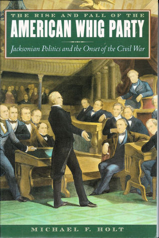
On my to-do list is another book I recently became aware of called The Rise and Fall of the American Whig Party: Jacksonian Politics and the Onset of the Civil War. I guess it could be titled “Everything You’ve Always Wanted to Know About the Whigs But Were Afraid To Ask”. It’s 1300 pages! Oh, and the print is tiny. At the rate I read it may take me as long as the Whig party existed to finish it. So far, everyone I know that has this book never read the whole thing. Regardless, this doorstop will at least serve well as reference material. Oh and a tip to used book buyers.

I also picked up an interesting old title called The Intimate Letters of John Cleves Symmes and His Family. I've seen reference to this early 20th-century book many times where Cleves is mentioned. Don't get too excited. These aren't like the Harding letters. "Intimate" in this case just means "personal". No extensive bio of this important man to the history of the Ohio Valley exists due to most of his letters and journals being burned in a fire. Some say it was arson. There were many lawsuits against the man due to his questionable land business dealings.  The letters that do exist were compiled here from some of his recipient's collections that survived. It sort of humanizes a person that tends to be just a static character in the story of others without any idea of his personal thoughts. One weird thing I learned. Cleves kept referring to a daughter he called "Nancy". He only had one daughter named "Anna" (who married William Henry Harrison) so that was confusing. It turns out "Nancy" was originally a nickname for "Anna". I never knew that.
I got this and the Whigs Tecumseh from AbeBooks for just a few dollars each with free shipping. Ironically I've learned this has been owned by Amazon since 2008 but Amazon's used prices were very high for each of these. I'll be shopping there more often for good used book deals!


Speaking of geocaching, the reason so many new caches are getting published around town and my reading has slowed is that a major Geocaching event called GeoWoodstock 2018 will be held May 26th, 2018 at Coney Island in Cincinnati. This event is expected to bring over 5000 geocachers from all over the world. In fact, a geocacher from France contacted me about carpooling from their Airbnb since I have a cache near the event. I had to politely decline as I don’t really know my full schedule for that day, but I will be attending! How could I not be with "my people" that day?

In personal geocaching news, I'm currently sitting at find 6,408 and have had some interesting cache runs lately. Lot’s of new FTF’s (First To Finds), including a Wherigo (a first FTF of this type if you will). That makes FTF 101 for me. Mark Fisher and I hit not one or two, but three “tunnel” caches in so many weeks. These are caches where you go into a large drainage tunnel, usually with a flashlight. The photo to the left is (eventually) 400' into a tunnel and about that many feet below I-74. I used to be pretty adverse to doing these. In one of them, I was ankle deep in water. Those were some fun adventures!

See you in June!

Tuesday, November 11, 2014

Price Thompson - First veteran of America's first war

Price Thompson 1756-1842
I tend to make note of Revolutionary War veterans graves when I am out and about. It's amazing what hardships they faced, before, during and after the war.
I was in Carpenters Run Cemetery looking for some of my pioneer Denman ancestors when I spotted Price Thompson's gravestone with an old flag and new plaque attached to it. Not only did I later uncover some interesting history, it turns out I am likely related to Price Thompson since he married a distant Denman relative of mine named Molly Denman.
Born in New Jersey on March 20th, 1756, Price Thompson was 20 when he saw his first Revolutionary War action at the Battle of White Plains, October 1776, a British victory. Over the next six years, he fought in several important battles.
Price enlisted for the duration of the war on December 18, 1776, with the 4th New Jersey Regiment. A week later, the day after Christmas, he fought at the Battle of Trenton against the Hessians, a force of Germans hired by the British. This was the first major American victory of the war. Most people recall this battle from history class because of the famous Washington Crossing the Delaware event that preceded the battle.
Private Thompson was also at the Battle of Brandywine September 1777. This was an American loss that forced a retreat resulting in the British capture of Philadelphia that lasted until 1778.
Price then spent the harsh winter of 1777-1778 at Valley Forge where 2,500 of the 10,000 Americans camped there died of starvation, disease, and exposure.
In June 1777, the 4th New Jersey Regiment took part in the Battle of Monmouth, an American-British draw.
By March 1779, Price transferred to the 1st New Jersey Regiment commanded by Colonel Matthias Ogden.
Americans tend to think of warfare from this period as relatively honorable European style affairs where opposing forces square off neatly and engage in battle. That was generally true, but messy lesser known activities such as Sullivan's Expedition took place. Thompson's new regiment participated in this retaliatory campaign over the Summer of 1779. It was a scorched earth style of war against the Loyalists and British allied Iroquois that destroyed over 40 Indian villages and their food supplies. This led to a terrible winter with a death toll numbering in the thousands from exposure and starvation.
Thompson survived all of this. He eventually made it all the way to the Siege of Yorktown and the surrender of Lord Cornwallis in 1781, which would end the war. That hard life doesn't end here.

Molly ThomPson 1763-1823
Notice the typo in the last same.
He was discharged from the army in 1783 as a corporal.
Thompson then married his first wife Mary (Molly) Denman in 1783 and had thirteen children.
As a reward for his service, he received Bounty Land Warrant #8788 for 100 acres on July 31st, 1789 from the Symmes Purchase in what would become Sycamore Township OH. This was just two weeks after the newly acquired Northwest Territory was formed by Governor Arthur St. Clair. In those days this part of Ohio was a violent and dangerous place due to ongoing hostilities with the British allied American Indians who still lived there. They didn't call it the Miami Bloodbath for nothing. Cincinnati/Losantiville was a brand new settlement, Ohio was not yet a state and the Treaty of Greenville was still six years away.
I never did discover Price's occupation but I found that sometime prior to 1824 he donated this acre of land to be used for a cemetery. In 1828 at age 72 he applied for his pension. He stated he served as a Drummer and a Corporal in the 1st NJ Line under Captain Holmes. US Pension Laws provided that every indigent person who had served to the war's close, or for nine months or longer, would receive a pension. Whatever his occupation was, he was unable to work at this point since the pension was essentially disability pay. Thompson being an enlisted man received $8 per month which equates to $200 in 2014 money. I thought it was worth pointing out that per the VA website, the amount of basic benefit paid in 2014 ranges from $127 to over $3,100 per month. Thompson would have received this meager pay with no other benefits in those days, until his death on March 1, 1842, at the age of 85. He served through nearly the entire Revolutionary War, into the 19th century, watched the US double from 13 to 26 states and lived through the first 10 US Presidencies!
There are thousands of "Price Thompson's" in old cemeteries across the US whose story is buried along with them. Remember their sacrifices and their stories, especially on Veterans Day.

other sources:
Battles of the American War of Independence - interesting site from the British perspective
Price Thompson at FindAGrave
Pension and land warrant information on Price Thompson
General info on Revolutionary War Pensions

Friday, June 27, 2014

Happy Birthday to Thee. Gehio Is Three!

Gehio is three years old today with over 20,000 page views. Thanks to all those who read (I look at my stats), leave comments and those who subscribe. I started this blog to help me remember the interesting history I encounter, mostly while out geocaching, but it's nice to know others enjoy it as well.
Speaking of stats, I noticed there have been 88 posts prior to today which is the same number of counties in Ohio. I love it when stuff like that happens.
Stats. The post with the most page views is Some quick Ohio history for September, a hodgepodge of This Month in Ohio History with some cartoon references. I had fun doing that one. In 2nd place is Going Underground on Hamilton Avenue about the Underground Railroad and in 3rd place is The death of Tecumseh. An historical sign about that Shawnee Chief started it all for me.

The most fascinating thing I've run across was the story I did on Ohio pioneer and land speculator John Cleves Symmes' nephew, also named John Cleves Symmes, who thought the world was hollow and inhabited. His odd theory indirectly led to the discovery of the Antarctica continent.
Geocaching+History+Ohio=Gehio

Another crazy but true story is how they carved up and boiled the remains of the American General Mad Anthony Wayne.
The recipient of the first Purple Heart is also buried in Cincinnati in a previously overgrown abandoned cemetery.
Along the way, I've learned that our brief 9th president William Henry Harrison wasn't just some insignificant rube. He played a vital role in the development of our country but then had the misfortune of ending on a bad note. He also passed out free booze at campaign stops in log cabin-shaped bottles. Huzzah!

These sort of things continue to remind me that interesting history is all around us waiting to be discovered. Past events are the story of who we are and how we came to be. Also, the weird stuff is just pretty damn cool.

Monday, January 13, 2014

Get to Know A River Part 1: The Mill Creek

There are four main rivers in and around Southwest Ohio that provided the main reason for the rapid growth and settlement of the region. This was the old highway system used by Native Americans, early explorers and settlers long before canals, railroads or paved highways. The Great Miami and Little Miami flank Cincinnati respectively to the West and East while the Mill Creek basically runs down the middle. These are all tributaries of the Ohio River. That's over 1200 miles of waterways in total which is the equivalent of going from Cincinnati OH to Denver CO.
In the 18th century, the land between the two Miamis was a dangerous area for settlers and known as the Miami Bloodbath due to constant Indian skirmishes and battles. Dotted along the banks of all these rivers from 1788 to 1795, over 40 stations and forts were built as protected settlements for Americans rushing in to claim land after the victory in the American Revolution.

Now let's get to know a river...or a large creek in this case.


a non-urban portion of The Mill Creek
The Mill Creek runs North to South for 29 miles from Butler County OH to the Ohio River just West of downtown Cincinnati.
Now technically it's not named a "river" but there really is no official distinction between rivers and creeks. A loose definition is that a creek is a minor tributary of a river. Basically, it got called a creek by John Cleves Symmes and the name stuck. More on that in a bit.

The average depth of this waterway is only about 3' in most places and averages about 60' wide in the Cincinnati area making it 1/4 the size of the Little Miami, in length, width and depth. Flood stage is at 12'. Much of the urban portion of the Mill Creek has fortified concrete banks and is what most folks see as they speed down I-75 aka The Mill Creek Expressway. Yes, sadly it looks like a big cement ditch in those places which happens to also be a graffiti canvas for vandals.

Mill Creek Barrier Dam Pumping Station 
The 1937 Flood left thousands homeless in Cincinnati because of water from the Ohio River backing up into the Mill Creek. The Mill Creek Barrier Dam Pumping Station project was completed in 1948 as a result of the '37 flood. When the Ohio River is flooding, the gates of the Mill Creek Barrier Dam Pumping Station and Dam close preventing the Ohio River from backing up into the populated Mill Creek valley aka Cincinnati. The water in the Mill Creek is then pumped back into the Ohio. Despite this safety measure there was still flooding in '59 that left 50,000 homeless.


Before settlers came, the Shawnee called the Mill Creek "Maketeewah" which meant “it is black” because of the dark rich soil that made up the bed of the creek that at the time was rich in wildlife.
city life for the Mill Creek
The name "Mill Creek" was coined in the 18th century by John Cleves Symmes as a marketing move to attract land buyers and millers to the area at a time when it was very dangerous to live in the area. Symmes needed to sell land so the river needed a name that wasn't so ethnic as well. Folks didn't want to think they were going to be killed by Indians. It did indeed attract much industry and growth but this once lush body of water was quickly transformed into an open sewer from all of the waste being continually emptied into it and eventually became known as "the most endangered urban river in North America".
Today, the Mill Creek, after 100 years of neglect has seen a revitalization due to efforts by several organizations such as the Mill Creek Watershed Council. People even canoe on the Mill Creek! As far as the name goes I'd like to see the boring Mill Creek name revert to the more poetic Makateewah, but you know me...

Approximate course of the Mill Creek


For more about the Mill Creek history and it's ecology I highly recommend the book The Mill Creek: An Unnatural History of an Urban Stream

Saturday, February 9, 2013

Tippecanoe and Trivia too!


WHH and the horse he rode in on in Cincinnati
Up until a few years ago, thanks to Trivial Pursuit and rushing from the Mayflower to the American Revolution and then on to the Civil War in history classes, (as if nothing really happened in between) I always thought William Henry Harrison was just some nobody who stumbled into the presidency, died 30 days later and that was pretty much it. End of story. I didn't even know he has a fantastic tomb just to the west of the city I call home, Cincinnati.

William Henry Harrison, Ohio's adopted son born February 9th, 1773 in the Virginia territory, the man I love to hate, the man I hate to love, one of Ohio's unsung founding fathers. He would have been 240 years old had he lived. The 9th President's life was cut short by a common ailment at the tender age of 68. The standard treatment of opium and leeches could not save him and he died of pneumonia 30 days later on April 4th, 1841.  In fact, the "cure" is probably what hastened his death and while he may have had pneumonia, typhoid is likely the real culprit.

1st photo of a sitting President
WHH's achievements tend to get overshadowed by the trivia surrounding his legacy but it is impressive trivia nonetheless:

  • first President to have a campaign slogan (Tippecanoe and Tyler Too!)
  • oldest elected President until Reagan (68 years, RR was 69)
  • the first sitting President to have his photograph taken
  • longest inauguration speech of any President (1 hr 45 min, 8,445 words)
  • first President to die in office
  • shortest term President (30 days, 12 hours, and 30 minutes)
  • last President born as a British subject before American Independence
  • only President to have a grandson follow him to the White House (Benjamin Harrison)
  • his Dad signed the Declaration of Independence (Benjamin Harrison V)
  • two states claim Harrison as their own. He was born in the Virginia colony before the American Revolution but he spent most of his life in the Ohio Valley as a military and political leader and had a home there.
  • supposedly he caused "Tecumseh's Curse" that caused the presidents elected or re-elected in years divisible by twenty to die in office...until Reagan broke the curse. The list of presidents who died includes 3 Ohio born presidents....hmmm. It should be noted that no mention of any curse appeared until 1931.
that's WHH at the Treaty of Greenville
But he was not a mere footnote in history as Trivial Pursuit and history class would lead you to believe. Prior to the Presidency, he had an impressive resume:
  • Present at the signing of the Treaty of Greenville in 1795 as an aide to Gen. Mad Anthony Wayne
  • Secretary of the Northwest Territory (modern OH, IN, IL, MI, WI, MN from 1798-1799)
  • Governor of the Indiana Territory (modern IN, IL, WI and parts of OH, MI and MN from 1801-1812)
  • Expanded US territory by 60 million acres*
  • Won the Battle of Tippecanoe against the Indian confederacy led by Tecumseh in 1811**
  • helped defeat the combined British and Indian forces in the War of 1812
  • Member of the U.S. House of Representatives from Ohio (1816-1819)
  • US Senator from Ohio (1825-1828)
  • Ambassador to Columbia (1828-1829) 
Harrison's tomb in North Bend OH
I realize that this list is not as fun as the trivia list but he seemed as suited, if not more than any other for the Presidency. He wasn't just some schmuck that fell off the turnip truck.
He did do some bad stuff too and some of the good stuff is dependent on how you look at it. For example, as Governor he played around with the wording of the law to keep slavery alive in the Indiana Territory as indentured servitude when slavery was supposed to be illegal there. *The thirteen land treaties with Native Americans were at best on shaky legal grounds. He knew full well that these treaties made him look very good so he obtained many of them on flimsy terms sometimes for personal gain. **The 1811 Tippecanoe battle that helped him get elected? This was considered a draw at best after it happened. In fact, it was originally considered a defeat for the US because of the number of casualties.

Much has been written about his engagements with Tecumseh. Tecumseh nearly killed him once at a meeting when Tecumseh uncharacteristically lost his temper out of frustration. That event certainly would have altered history. WHH  finally helped end the life of Tecumseh at the Battle of Thames during the War of 1812. I sometimes wonder if as Tecumseh laid there dying he regretted not killing Harrison when he had the chance.

Marysville OH (he never lived in a log cabin)
In life and in death he was portrayed as a simple man who was born in a log cabin. This, however, is not true. Harrison was born on a Virginia plantation to a wealthy prominent family and was well known for making long drawn out speeches that referenced and quoted Roman Emperors and military leaders. He really saw himself and wanted others to see him, in this light. Even the home he had built in the Indiana wilderness, Grouseland was a mansion for that time period. He was an American aristocrat who married Anna Symmes, the daughter of land speculator Judge John Cleves Symmes who at first was opposed to Harrison, whom he considered only a mere military man with no future. The myth of his humble beginnings was created to get him elected President. Ironically it was originally used as a slur by his political enemies, Harrison's team ran with it and transformed their man into a "real" man of the people. Sound familiar? Presidential candidates have been doing it ever since. Happy Birthday Mr. President.


Friday, November 18, 2011

WKRP in Losantiville

the first settlement happened right here 11/18/1788
Cincinnati folks learn that their city was founded in 1788. There are signs around the perimeter of the city on the different highways that seem to confirm this.
There was actually no such thing as a community called "Cincinnati" until 1790. It also wasn't incorporated as a village until 1802 and not incorporated as a city until 1819. Let me explain.

After the Revolutionary War formally ended with the signing of the Treaty of Paris in 1783, the US Congress established 260,000 square miles called the Northwest Territory in July 1787 which was previously under British rule. This paved the way to establish the modern states of Ohio, Indiana, Illinois, Michigan, Wisconsin, and Minnesota in the 19th century.

John Cleves Symmes came along and purchased a chunk of this land between the two Miami rivers, had it surveyed, and began reselling it to potential settlers. Out of these land sales, 3 settlements along the Ohio River were established:

Stites has a nice grave marker in Columbia
Columbia was the first settlement by a man named Benjamin Stites and 26 settlers on November 18th, 1788.
Columbia was a Romanesque term widely used then to refer to America and American things in the early days and was, of course, derived from the name of Christopher Columbus. Stites had been to the area previously while pursuing Indian raiders who had stolen horses in Kentucky. He decided to purchase land from Symmes when it became available. This settlement was on the Ohio River at the mouth of the Little Miami River near where present-day Lunken Airport is located. This original settlement was destroyed by flooding and the subject of frequent Indian attacks. Today, the "East End" is one of modern Cincinnati's oldest neighborhoods called Columbia-Tusculum with 3000 people. Benjamin, along with many of the other original settlers is buried near the original landing in a cemetery across from Lunken.

Cincinnatus gets a statue at Yeatman's Cove
The second settlement, Losantiville, was about a month later on December 28th, 1788. Colonel Robert Patterson and Israel Ludlow and their party arrived at a spot a few miles up from the Little Miami on the Ohio River at the mouth of the Licking River. This is near present-day Yeatman’s Cove in downtown Cincinnati. The expedition was financed by Mathias Denman. This is the date and place that is credited with the founding of modern Cincinnati.
John Filson, who surveyed this area earlier in 1788, created the name Losantiville which meant "the city opposite the mouth of the Licking River" from the following:
"L" for the Licking River in KY on the other side of the Ohio.
"os" from the Latin for mouth.
"anti" from the Greek for opposite.
"ville" which was French for city.
Filson actually disappeared earlier in 1788 near Losantiville during a survey. No one really knows what happened to him and his body was never found. He may have been captured by Shawnee or he may have gotten lost and died in the wilderness. Either is plausible since Filson really wasn't much of a frontiersman and more of an historian and bureaucrat.

Now for some Cincinnati related Daniel Boone trivia!...It was Filson's mostly factual 1784 "Adventures of Colonel Daniel Boone" that made Boone one of America's best known legendary folk heroes and made him famous worldwide. It was also Daniel Carter Beard's 1905 "Sons of Daniel Boone", founded in Cincinnati, that became the modern-day Boy Scouts. The I-471 yellow "Big Mac Bridge" bridge that crosses the Ohio near Yeatman's Cove is officially named for Beard.

Symmes got a nice sign near his grave


The third settlement, North Bend, was February 2nd, 1789 a few miles East of present-day Cincinnati near the mouth of the Great Miami on the Ohio River and was the town that John Cleves Symmes himself started.
It was named so because it was the most northern bend in the Ohio River. This was the settlement that Symmes thought would become the most successful but it turned out that the area, like Columbia, was prone to constant flooding and not sustainable. This area did later became the home of future President William Henry Harrison who married Symmes daughter Anna but this area did not grow as much as Symmes had hoped. Harrison's Tomb is here as well. The grave of father-in-law John Cleves Symmes is adjacent to the tomb. North Bend remains today as a small 1.2 sq mi village of about 600 residents.

Ft Washington Marker near Lytle Park
Besides the flooding, what really made the second settlement of Losantiville take off was the 1789 addition of Fort Washington  by Northwest Territory Governor Gen. Arthur St. Clair near present-day 3rd & Broadway. This certainly made would be settlers feel a bit safer.
St. Clair wanted to make that area the seat of the territorial government but he didn't like the name Losantiville and renamed the new city to Cincinnati in 1790. There really wasn't much objection to this as it was the now dead Filson who came up with Losantiville anyway.
It is an often repeated falsity that Cincinnati was named directly for the Roman farmer turned leader turned farmer Lucius Quinctius Cincinnatus. St. Clair actually named the city after the club of Revolutionary War veterans he was president of called the Society of the Cincinnati that honored George Washington. The members saw Washington as a modern day Cincinnatus. This, of course, pleased his friends and his boss George Washington, very very much. In 1791, after St Clair lost a major battle to the Indians at St Clairs Defeat, Washington fired him from the Army but let him remain as Governor of the Northwest Territory. Several years later, over political differences about the territory, after 15 years as Governor, President Jefferson fired him in 1802 and Ohio became our 17th State in 1803 or the 49th in 1953. I find it ironic that a man who presided over a club nobly named for a farmer turned leader turned farmer had no intention of doing so himself. Politicians always have like the "do as I say not as I do" motto.

St Clair got a rock at a busy intersection
So, while the area which grew to become known as Cincinnati was formally settled in 1788 there were actually earlier settlements in the area (such as the 1785 Fort Finney near North Bend) but it was not officially called Cincinnati for 2 more years until 1790 when a gouty fat cat governor by the name of Arthur St. Clair tried to impress his boss and his friends. That's probably too much to fit on a sign on I-75.

Thursday, July 28, 2011

what a Symmes hole!

We all know that John Cleves Symmes was a Judge and the surveyor of most of the SW Ohio area between the Great Miami and Little Miami Rivers in the late 1700’s known as the Symmes Purchase...right? There are roads, businesses, schools and a township named for him so you should at least recognize the name. In case you are unaware, his job was to hire folks to measure out the Ohio Valley into property to would be settlers for a low low price so that it could be developed into settlements for the budding US. Well, this isn't about THAT John Cleves Symmes. I'll leave him for a different post...
that's the hollow earth up there

Judge Symmes had a nephew, also named John Cleves Symmes,  who believed the Earth was basically hollow like a shell, we lived on the outside, but the inside had a delicious nougat center. Actually, he thought the inside was a series of nested hollow spheres inhabited by others and he wanted to visit there to prove it.
The idea of a hollow Earth wasn't really that crazy in the early 19th century and had been proposed by ancient philosophers as well as scientists such as British astronomer Edmund Halley of comet fame and the mathematician & physicist Leonhard Euler.
In Hamilton Ohio there is a monument to Symmes and his theory at his grave site. I visited there with my friend and fellow geocacher Mark Fischer (& son) in May of 2010. I likely would have never known about this had it not been for the geocache nearby that brought us here.

Symmes was born in New Jersey in 1779 and named after his famous Uncle. At some point, he added "Jr." to his name to stop the confusion between him and Uncle Symmes. In 1802, Jr began serving in the US Army and rose to the rank of Captian and fought in the War of 1812. After leaving the Army, he developed his Theory of Concentric Spheres and Solar Voids after reading Halley and Euler's ideas. Symmes himself was not a trained "natural philosopher" as scientists were called then, but he read a lot of science books and spent most of his post Army life on the lecture circuit discussing his version of the theory. He even tried to get the US government to finance an expedition to the 1400 mile wide opening or Symmes Hole as it was called, at one of the Earth's poles to reach the delicious center via the giant hole. President John Quincy Adams thought this was a grand idea but incoming President Andrew Jackson said no way. His money was all tied up on some 19th-century style ethnic cleansing of American Indians.**

**this sentence is pure speculation on my behalf, but Jackson did hate American Indians something fierce

plaque added that mirrors faded inscription
Symmes never even wrote a book on his theory (details details) but did publish a very nice pamphlet about his hollows and holes. One of his ardent followers and Hamilton's first Mayor, James McBride wrote a book called Symmes' Theory of Concentric Spheres in 1826.

Americus Symmes' tribute to dear old Dad
Symmes Jr. died at the age of 49 in 1829 still believing his theory and was buried in present-day Hamilton OH in his own Symmes Hole.
A follower named Jeremiah Reynolds finally did help persuade Congress to fund an expedition after Symmes' death and the resulting 1838 US Naval "Wilkes Expedition" ended up discovering a new land mass rather than just ice where Antarctica is. So, in effect, Symmes Hollow Earth theory led to the discovery of our 7th continent. Sorta.

His son Americus Symmes erected this monument in 1873 at his grave site. The inscriptions on the monument have been worn down over the years and plaques have been added that reproduce the words. There was a larger cemetery here at one time but for some reason, many of the people buried in this cemetery were re-interred in a larger place nearby. Symmes Jr still remains in this tiny fenced plot which is surrounded by a city park and playground. I'm sure the kids that playing with their hollow sphere basketball near the monument have no idea what's going on 300 feet from them.


I declare the earth is hollow and habitable within; containing a number of solid concentrick spheres, one within the other, and that it is open at the poles 12 or 16 degrees; I pledge my life in support of this truth, and am ready to explore the hollow, if the world will support and aid me in the undertaking. - John Cleves Symmes Jr., 1818

See more pictures of the monument here


Tuesday, July 12, 2011

Bond, Bond Hill

I pass through a part of town called Bond Hill, a neighborhood in Cincinnati OH, on my work commute and have often wondered about its history. Based on what I see on my drive and on the news it's seen better days and I figured it must have a story to tell...

Settlers first arrived in the late 18th century in what was then prime Shawnee hunting grounds. Since not all of the Shawnee bands signed the Treaty of Greenville in 1795 which ceded most of Ohio north of the Ohio River to the Americans, some still fought on for nearly 2 decades to keep this land free of settlers.

The stream and tributary of the Mill Creek that runs through this community is called Bloody Run and achieved its morbid name long ago due to several deadly skirmishes that ended poorly for the would-be settlers along present-day Route 42/Reading Rd then known as Harmar's Trace, a military road built over an ancient buffalo trail. One incident was the 1792 skirmish with the Shawnee that resulted in the death of Moses Pryor and his daughter who ventured outside the small fortification called White's Station in present-day Carthage. Another deadly incident in 1794 involved several federal postal workers. Successful settlement didn't really occur here until after the death of the Shawnee Chief Tecumseh in the War of 1812 when most Native Americans had moved west to the Indiana Territory.

The odd thing is no one is really sure exactly which "Bond" person this community is named after or who came up with the term which was in use prior to the 1830's. The best theory is that it was named after the lawyer, Congressman and surveyor named William Key Bond who lived in Cincinnati from 1841-1864 who is buried in nearby Spring Grove Cemetery but it is not known if he was the namesake since no one bothered to write it down. There is no record of him or any other Bond owning land in this immediate area but it is likely he helped survey this area before he resided here permanently.

Bond Hill is also definitely not on or very near a hill. Historians speculate that it was called a “hill” as a deception to attract land buyers at a time when settling on higher ground was more desirable for safety against flooding and Indian attacks. The renaming of nearby Mill Creek from its Shawnee name Makateewa is another example of a PR move by the land speculator John Cleves Symmes to attract millers to buy land at 67 cents per acre to this hostile area in the 1790's.

marker for the Miami-Erie canal in nearby St. Bernard

Bond Hill also had the Miami-Erie Canal to the west in the mid-1800's that attracted travelers to the rural and open spaces away from the city to the South. You wouldn't know it now but there were once nice orchards and farms before the city blight. In place of the canal now is Interstate 75 which some residents and some maps still refer to as the Mill Creek Expressway.

The signs in the area show the area was officially established in 1871. Bond Hill was developed then as a railroad town and cooperative by temperance members seeking a spot for affordable housing free of the scourge of alcohol. This group of individuals actually had planned this community in present-day Northside but for unknown reasons chose the Bond Hill area several miles to the East.

Incidentally, in this part of town is Maketewah Country Club established in 1910 and named for the former name of Mill Creek. At one time on their website, they said this was a Mohawk term that meant "land of the mill valley" but this is absolutely false since the mills came with the white settlers and there really were not any Mohawks in this area either. I emailed them about that once and they never responded but I see now that this reference is gone. Makateewa simply meant "it is black" which once referred to the rich dark soil on the bed of this large creek that runs through Cincinnati.

And that is a brief history of Bond Hill.